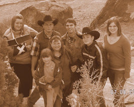
In its own way Montana really stands out. I know there arent a lot of people (when you think about large urban populations) but nearly all the people I care about are here. Montana is ever changing and ever the same....I love its unpredictability in weather patterns (see top ten weather events of Montana attached below) I love the consitancy of the kind generous people, and I still get excited about the small things....green grass, wide open spaces, luscious amber fields of grain, green potato plants and their purple blossoms. I love the wide variety of color and texture in the landscape. Most of all I love the feeling I get when I look anywhere in Montana and see how much my Father in Heaven loves me. The beauty that surrounds me day to day makes me marvel at the incredible ingenuity and love that our Father in Heaven used to create such a place for us. I think that these marvelous places and feelings are to help us remember Him and find the strength within our souls to keep us moving strong and steady with an eye single to the Plan of Salvation and the Glory of God. Montana symbolizes my true potential and I love being here.
I thought this was kind of interesting.....we say in Montana that weather forcasters really aren't important because the weather can and will change in the blink of an eye....so see for yourself and remember....if you come to Montana ALWAYS come prepared for any variety of weather. LOVE YA!!!
Top Ten Montana Weather Events of the 20th Century
#10). July 5, 1937. The temperature topped out at 117F at Medicine Lake in northeastern Montana. This tied the all-time high temperature for Montana previously established at Glendive on July 20, 1893. Combined with the -70F at Roger's Pass in 1954 (#6), this makes the all-time temperature range recorded in Montana 187F. This is the most extreme temperature range experienced in any of the 50 United States.
#9). January 11, 1980. The temperature at the Great Falls International Airport rose from -32F to 15F in seven minutes as warm, Chinook winds eroded an Arctic airmass. This 47 degree rise in seven minutes stands as the record for the most rapid temperature change registered in the United States.
#8). December 14, 1924. The temperature at Fairfield, Montana (about 20 miles WNW of Great Falls), dropped from 63F at noon to -21F at midnight. This 84 degree change in 12 hours still stands as the greatest 12 hour temperature change recorded in the United States.
#7). April 25-26, 1969. A late season storm brought a drastic change in weather to eastern Montana. A day after numerous stations registered their highest temperature for the month (many in the 80s), a cold front swept through Montana bringing blizzard conditions to much of the eastern half of the state. Temperatures fell more than 50 degrees in 24 hours with wind chill readings well below zero for nearly 48 hours.
Snowfall amounts of over 1 foot were widespread with higher amounts including a 32 inch tally reported near Sonnette. Wind whipped the fresh snow into drifts reported to be over 20 feet high in places. Power and phone lines were knocked out. Utility lines downed over a 12 county area resulted in losses of nearly $2 million (1998 dollars). Some residents of southeastern Montana were without power for two weeks and without telephone service for over a month. Over 100,000 sheep, horses and cattle were lost with cost in today's dollars tallying well over $10 million.
#6). January 20, 1954. The temperature at Roger's Pass, Montana, (about 25 miles NW of Helena) dropped to -70F (not a wind chill). This still stands as the coldest temperature ever recorded in the lower 48 United States.
#5). January 23, 1916. An Arctic cold front slammed through Browning, Montana, dropping the temperature from 44F to -56F in 24 hours. This 100 degree change stands as the most dramatic temperature change ever recorded in 24 hours in the United States.
#4). January 30 through February 4, 1989. A bitterly cold Arctic air mass invaded the northern Rockies bringing record cold temperatures and extreme wind chills to Montana. Ahead of the front, on January 30th, downslope winds gusted to 100 mph at Shelby, 102 mph at Cut Bank, 114 mph in Augusta, 117 mph at Browning and 124 mph at Choteau. Twelve empty railroad cars were blown over in Shelby. Elsewhere, roofs were blown off homes, mobile homes were rolled over or torn apart and numerous trees and power lines were blown down.
With the passing of the Arctic front on the 31st, temperatures dropped dramatically. In Helena, the temperature remained colder than -20F for 84 hours (three and a half days) including a record low, -33F, on the fourth. Wind chill values during this period dropped to -75F. The cold caused the brakes to fail on a freight train. The train then rolled, uncontrolled, into Helena and exploded causing extensive damage to Carroll College.
In Billings, record lows were established for 5 consecutive days. Bozeman set record lows for four consecutive days. In Missoula, record lows of -22F and -23F were established on the 2nd and the 3rd, respectively. Wisdom, Montana, saw the mercury drop to -52F on February 3rd.
As the cold front moved through Great Falls on January 31st, the temperature dropped from 54F to -23F (a 67F change) and did not rise to above -20F until February 4th. This included two record low temperatures (-35F and -33F) on the 3rd and 4th.
Between January 30th and February 5th, four people lost their lives with damage estimates well into the tens of millions of dollars.
#3). June 22, 1938. Torrential rain-producing thunderstorms caused flash flooding on the Yellowstone, Musselshell and Sun Rivers. But, the worst flooding occurred downstream of the Bear's Paw Mountains near Havre.
More than 5 inches of rain fell in the Gravelly Coulee watershed in one hour creating a wall of water which rushed out of the foothills, traveled 10 miles and still managed to erode two miles of Great Northern Railroad track near Laredo. Farther east, nearly $500,000 damage (nearly $4.5 million in today's dollars) occurred in Havre as the normally dry Bull Hook Creek spread a half mile wide on its route through the center of town. Two inches of rain fell in Zurich in one hour with 3.55 inches falling during the early part of the night. At least 8 people lost their lives as a consequence of the flash flooding. Farther south, in Fort Benton, 27 small bridges were washed out. The Carter Ferry was swamped and sank near the banks of the Missouri River.
#2). 12:34 A.M. June 19, 1938. Tremendous rains over the Prairie County Highlands north of Terry, Montana, produced a flash flood which roared down Custer Creek and into the Yellowstone River. The wall of water weakened or destroyed a railroad trestle just before an 11-car passenger train of the Chicago, Milwaukee, St. Paul Railroad Company known as the "Olympian," crossed.
The train, moving at full speed, ran head-on into the far bank of Custer Creek. Of the 140 people on board, 49 perished and 65 were injured. Some of the bodies were carried 130 miles downstream to Sydney, Montana.
#1). Saturday June 6, 1964. A slow moving line of thunderstorms brought torrential rains to the Rocky Mountain Front of western Montana. Record 24 hour rainfall amounts of 8 to 14 inches fell along the east slopes of the Continental Divide. Near the Bob Marshall Wilderness Area, Gibson Reservoir received enough inflow to fill it two and a half times. The dam is 195.5 feet tall and contains 99,057 acre-feet of water when full. Water flowing out of Gibson Dam flows into the Sun River. The Sun River runs southeast toward Great Falls where it empties into the Missouri. Typically, the flow of the Missouri would cause a backwater on the Sun River. On June 9th and 10th, however, the flood wave of the Sun caused the Missouri to back up, flooding the Meadowlark Golf Course and the Country Club Addition. Nearly 3000 people were evacuated from western Great Falls as 10 to 12 feet of water spread over the area. Advance warning, however, helped prevent any loss of life.
Farther north, the rain continued through Sunday, June 7th. In Glacier National Park, the torrents caused Divide Creek to spill its banks. Logjams were releasing periodic flash floods. Scores of tourists were stranded in campgrounds and lodges as all communications and power were knocked out. Downstream, more than 30 people lost their lives on the Blackfoot Reservation.
Tributaries of the Marias River saw several irrigation dams breech. Along Birch Creek, a flood wave devastated the Birch Creek Valley with a 20 foot high wall of water destroying any buildings and bridges in its path. 19 people lost their lives there.
The dam on Lower Two Medicine River also failed releasing a flood wave which claimed 9 more people.
At least 58 people were killed by the torrential rain and the resultant flooding and flash flooding.
skip to main |
skip to sidebar


We're just taking life one day at a time....me, my little quirks, and I.
Labels
- The beginning (1)
Blog Archive
-
▼
2010
(16)
-
▼
May
(10)
- Something quick and thought provoking tonight. Lo...
- Caught!!!
- Para que sepas! (Just so you know!)
- As we go on, We remember, all the times we, spent ...
- Compulsive.....and Cute
- Laughter for 60 years and counting
- Blog Fever
- One Fine Day
- In its own way Montana really stands out. I know ...
- Two roads diverged and I, I took the one less trav...
-
▼
May
(10)
Followers
About Me

- Jennifer Maughan Duke
- I love being married to my sweet hubby Chris. Marriage isn't perfection, but bliss is in seeing your best friend smile because you make them happy. I am so grateful to know that I have been sealed to him in the Temple for eternity. I love that we work together everyday to make sure we make it to eternity together....now if only I could figure out how to keep my house cleaned like I want.....

At the Grand Canyon


1 comments:
Thanks for reminding us of the extreme's that often are seen here in Montana. On that that's seldom talked about is the wind here in East Glacier. It is common from one year to the next to have sustained winds over 80mph with gusts well over 100. I know it's the only place i have ever lived where the wind is the street sweepers, the sand and gravel is launched with the winds . . . Thanks for the great blog post!
www.tonybynum.com
www.glacierparkphotographer.blogspot.com
Post a Comment